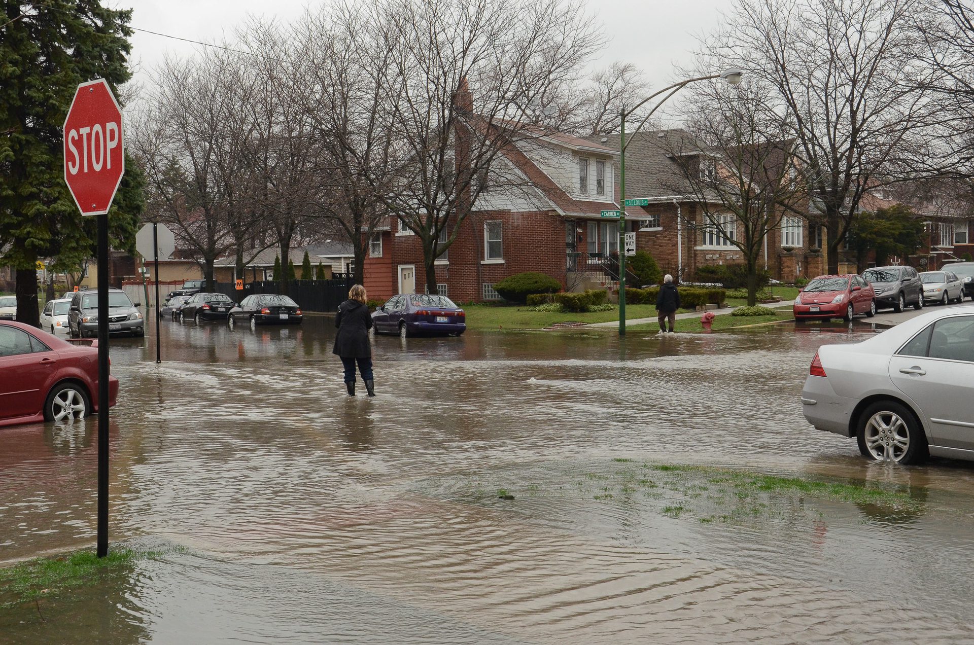
 Photo courtesy of Center for Neighborhood Technology, licensed under CC BY-SA 4.0
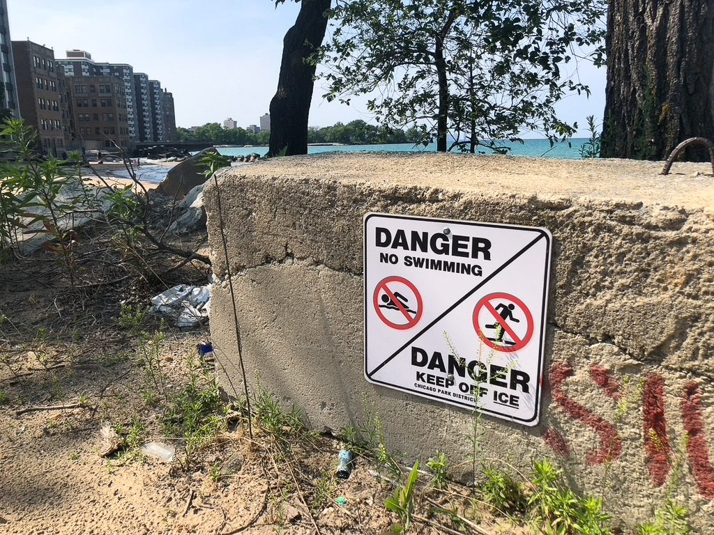
 Throughout the Great Lakes region, archaic wastewater systems, crumbling infrastructure and segregated housing create a perfect storm of flooding vulnerability.
This summer’s Independence Day weekend was meant to be a historic moment for Chicago, featuring the first-ever NASCAR street race with cars speeding through the city’s downtown. But these plans were partially derailed as history was made for another reason.
News that puts power under the spotlight and communities at the center.
Sign up for our free newsletter and get updates twice a week.
Record rainfall inundated city streets, flooded underpasses and swamped more than 2,000 basements including many with sewage. Like many climate disasters, the flooding disproportionately impacted the city’s most vulnerable, such as immigrants and communities of color.
The swollen Chicago River’s flow was reversed, allowing stormwater and untreated sewage to pour into Lake Michigan, the drinking water source for millions. Mayor Brandon Johnson, who lives on the city’s West Side, which was hit hard by the flooding, described the disaster as a sign of climate change and a harbinger of things to come.
As this six-part collaboration will highlight, cities throughout the Great Lakes region face similar crises, with archaic wastewater systems, crumbling infrastructure and segregated housing creating a perfect storm of flooding vulnerability from sources that range from excessive rain and overflowing rivers to lake storm surges and sewage system flooding. Rural areas, Indigenous communities and ecosystems in the Great Lakes also face severe risk from flooding, endangering hard-fought gains in environmental restoration and community development. In each instance, environmental justice issues go hand in hand with flooding risks, and partnerships with impacted communities are key to finding solutions.
Community Involvement
In June, the Biden administration announced sweeping climate resilience initiatives that include reducing flood risk, “supporting and learning from tribal communities” and advancing environmental justice.
The Bipartisan Infrastructure Law and Inflation Reduction Act include funding to address climate change and bolster resilience in coastal areas including the Great Lakes. The Inflation Reduction Act includes a US$575 million National Oceanic and Atmospheric Administration (NOAA) project to assist these communities with “natural infrastructure,” carrying out “community-led relocation” and otherwise protecting against extreme climate impacts, in keeping with the administration’s Justice40 Initiative mandating at least 40% of investments go to disadvantaged communities.
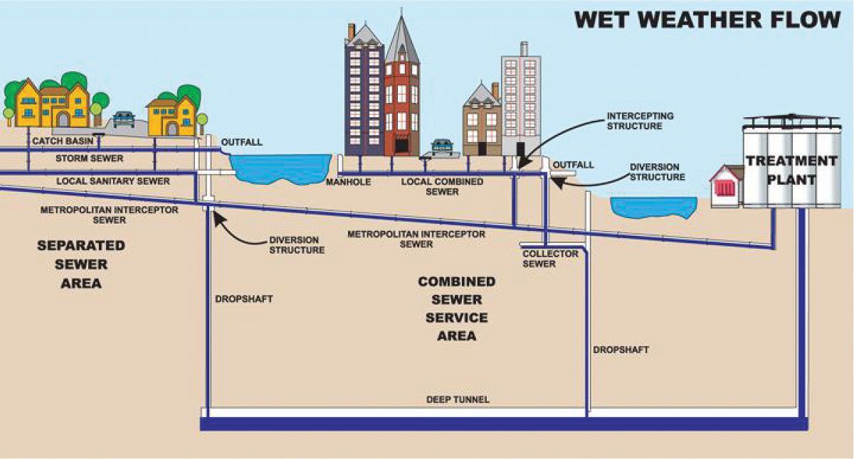
The Bipartisan Infrastructure Law also includes US$11.7 billion — on top of existing base funds — for the Clean Water State Revolving Fund, which offers below-market-rate loans and some federal grants to upgrade wastewater treatment infrastructure. This is especially important to deal with combined sewer systems that carry both stormwater and sewage and become overwhelmed during heavy rain, causing sewage to bubble up into basements and necessitating sewage releases into rivers and lakes.
Basement flooding from overburdened sewage systems is not covered by the National Flood Insurance Program (NFIP) administered by the Federal Emergency Management Agency (FEMA), which provides affordable flood insurance, produces flood-risk maps and mandates flood-related zoning and building codes for the nearly 23,000 communities covered by the program.
“It would be unrealistic to expect FEMA to map areas that would be vulnerable to urban [sewer system] flooding because they’d have to have perfect information about [cities’] storm sewage systems, and frankly most cities don’t have that information themselves,” says Rob Moore, a senior policy analyst at Natural Resources Defense Council (NRDC).
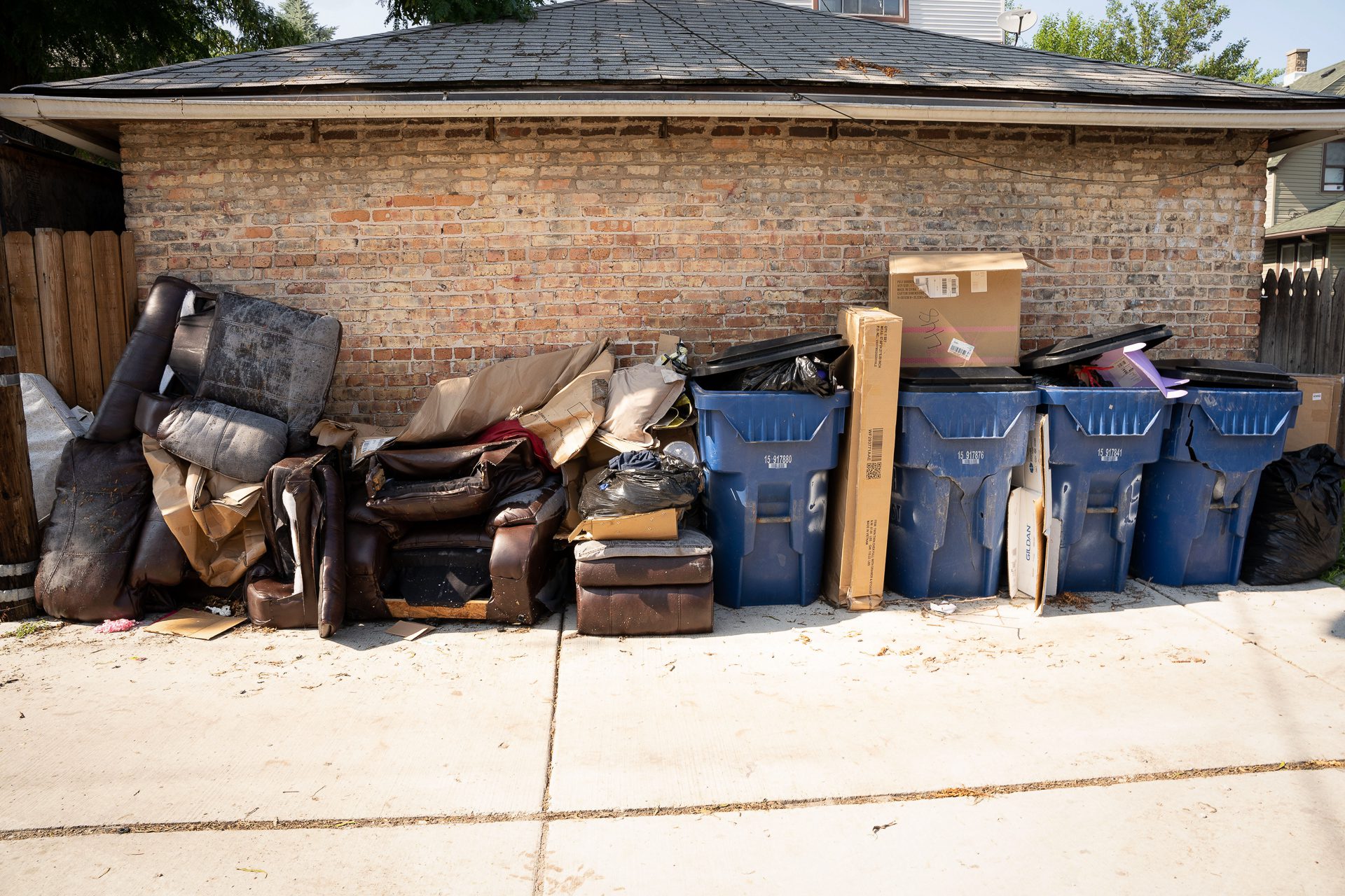
So residents dealing with devastating basement flooding that plagues Chicago, Detroit and many other Great Lakes cities during heavy rains are left struggling with a patchwork of city programs and private insurance to deal with the health and financial implications.
Community leaders and other experts say funding and initiatives such as those created by recent federal legislation must be deployed strategically and equitably to prepare the Great Lakes region to better withstand flooding, while all levels of government must prioritize resilience and aid for flooding survivors. This includes revamping the NFIP, reforming city and state policies on flood preparedness and relief, and investing in green infrastructure.
And it is crucial to make sure the communities most affected by flooding have leadership roles in developing and implementing policy.
“Authentic community engagement starts from the ideation stage all the way through to implementation” of policy, says Crystal M.C. Davis, vice president of policy and strategic engagement for the Alliance for the Great Lakes, a nonprofit Great Lakes protection organization. “It’s imperative if we are seeking to be equitable that we invite community representatives to be at the table from the very beginning of these conversations.”
But Milwaukee residents say state officials have treated community input as an afterthought as they advance a US$1.2 billion highway project that could cause more flooding.
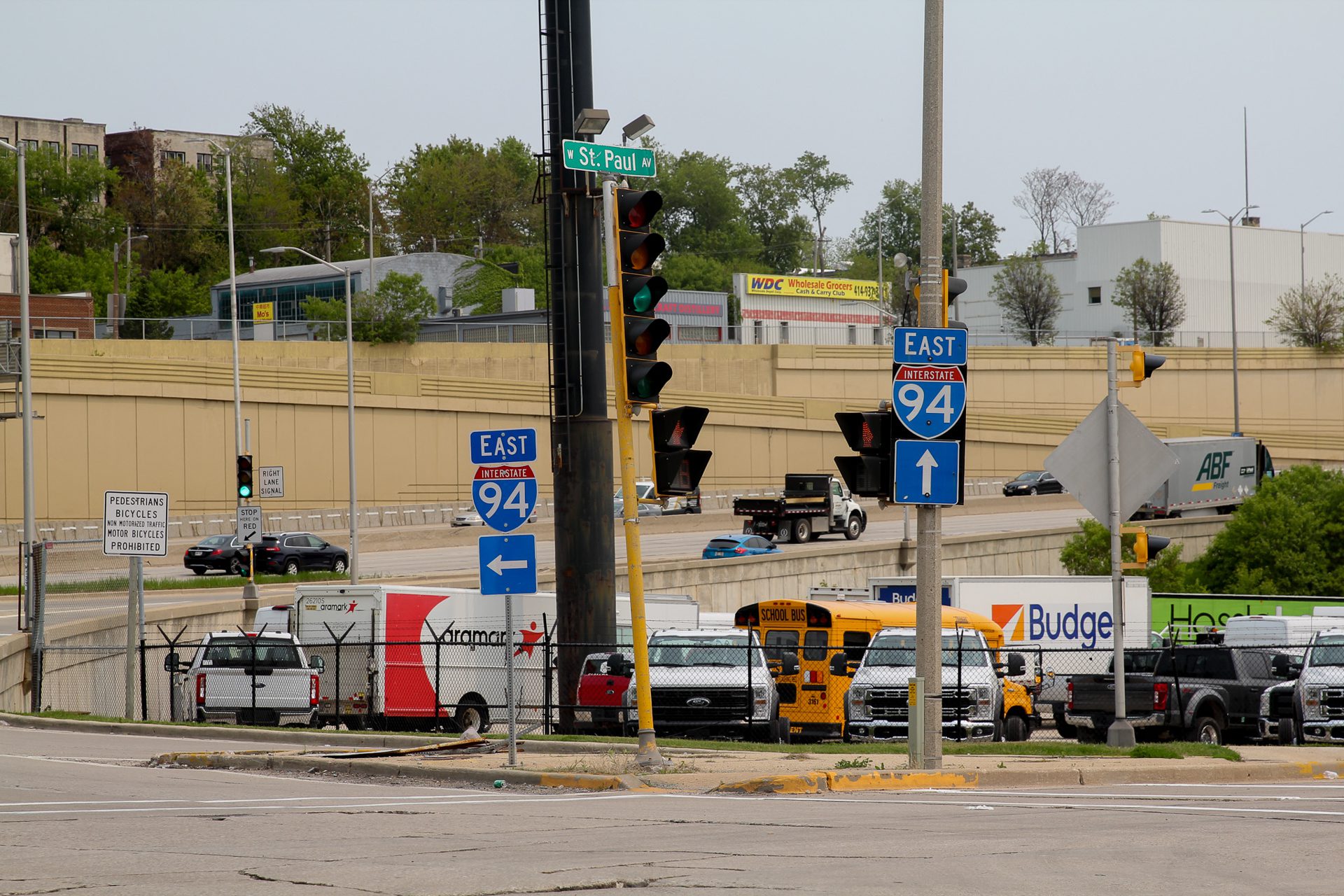
As Wisconsin Watch reports, the state is expanding the I-94 highway and the added pavement will likely cause more stormwater runoff. The surrounding neighborhoods that are at risk for flooding are disproportionately home to people of color. The state transportation department acknowledges up to 29 acres (12 hectares) of new pavement could cause problems, but the department won’t analyze the precise impacts until the final design stages of the project.
A Unique Position
In some ways, the Great Lakes region is well-positioned to withstand climate change, and even reap some benefits. The region has an abundance of available freshwater, and longer growing seasons could have some benefits for agriculture.
But flooding is among the dire threats that climate change does pose in the region. And the social and economic impacts of flooding could be exacerbated if more people and businesses move to the Great Lakes as a refuge from extreme effects of climate change elsewhere.
The Great Lakes region historically has been home to heavy industry, with countless factories, steel mills and power plants located on lakes and rivers. This legacy poses particular risks, as flooding can spread toxic contamination into communities and drinking water sources.
“The challenges are especially prevalent along the Great Lakes because industry has long operated on the shoreline in order to have access to water,” says Howard Learner, executive director of the Environmental Law & Policy Center (ELPC). “That’s frankly different than most other regions. If you look at the West Coast or East Coast, shoreline property is largely used for residential activities combined with ports and marinas. In addition, the Great Lakes are freshwater — increasingly a scarce domestic and global resource.” So the stakes are arguably higher if flooding contaminates that water.
In its 2022 report “Rising Waters,” the ELPC notes that while Great Lakes water levels have always fluctuated, climate change is driving more extreme highs and sometimes lows. The six-foot swing between a record low monthly average level in 2013 and a close-to-record high in 2020 is “unprecedented,” the ELPC report says, and new record highs are likely in coming years.
Drew Gronewold, associate professor at the School for Environment and Sustainability at the University of Michigan, notes that warmer temperatures mean increased evaporation from the Great Lakes, which can modulate water levels, but warmer temperatures also increase precipitation. If a climate event like a polar vortex curbs evaporation, then lake water levels can rise drastically.
“The ocean is getting warmer, the atmosphere is getting warmer, the oceans are evaporating more and the atmosphere can carry more of that water to the Great Lakes” in the form of precipitation, he notes. Meanwhile the Great Lakes can flood surrounding communities even without high water levels, as more intense windstorms create powerful waves.
“Whether the water levels are high or not, the Great Lakes can be rockin’” during storms, Gronewold says. “You can have 20-foot [6-meter] waves. We have evidence that through climate change, these storms are getting more intense.”
Along miles of Chicago’s lakefront, such storms mean trouble for homes, businesses and roads. Between 1996 and 2014 the Army Corps of Engineers spent more than half a billion dollars bolstering eight miles (13 kilometers) of Chicago shoreline, the ELPC report notes, yet during 2019–2020’s high water levels, waves caused half a billion dollars in damage.
As Grist reports, in Chicago’s South Shore neighborhood, a century-long battle with the lake has worsened with climate change. A catastrophic storm in 2020 had devastating consequences, causing flooding in homes, large sinkholes and washed-out beaches. In the wake of Lake Michigan’s encroaching waters, residents of the lakefront neighborhood have organized to prompt solutions, and created a voice so loud that politicians, engineers and bureaucrats have rallied around the group to carve a path forward.
The RainReady program in Chicago also aims to enlist residents in creating green infrastructure like permeable pavement and rain gardens that can reduce flooding in hard-hit neighborhoods, including by revamping vacant lots. As Borderless Magazine reports, the RainReady program has two facets that are inadequate in many other local-level flood mitigation efforts: community leadership and serious funding.
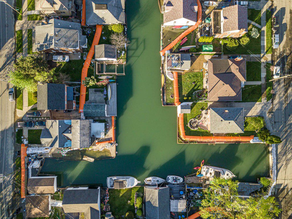
Meanwhile, in Detroit, flooding has been especially problematic in the Jefferson Chalmers neighborhood, a historic area known as “the Venice of Detroit” for its canals and proximity to the Detroit River, Planet Detroit reports. In 2021, FEMA designated parts of the neighborhood as Special Flood Hazard Areas. The city of Detroit has signaled it will fine or litigate against those with defective or missing seawalls, which can cost tens of thousands of dollars to replace or rehab. The financial stress on lower-income residents in the majority-Black neighborhood could accelerate displacement and gentrification.
“Hard” infrastructure, such as seawalls, is often not the best approach to flood control. Experts often recommend dispersing river waters with “soft” approaches like creating wetlands and slowing down a river’s flow.
“The solution can’t be trying to put up concrete and steel barriers to cordon off these places; all that does is push the water on someone else,” says Learner. “This is a matter of modernizing our land-use planning and zoning practices to adjust to today’s climate change realities and using the federal climate resilience funds to help ease the transition.”
Planning Gaps
There is no shortage of data showing how rainfall has increased and storms have become more intense in recent years, attributed to climate change, in the Great Lakes region.
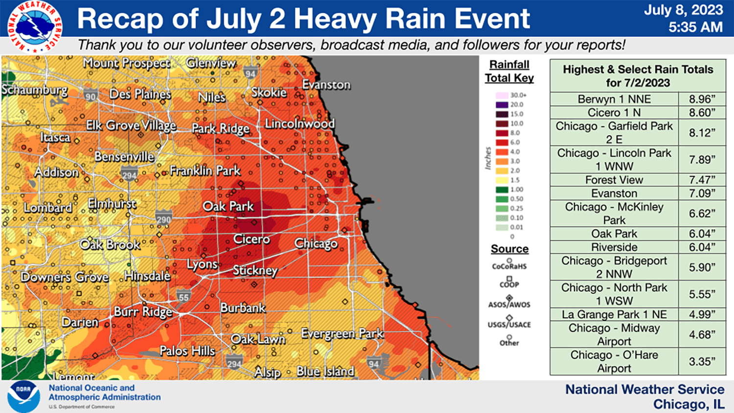
In the Great Lakes basin, the annual mean temperature was 1.6°F warmer in 1985–2016 than 1901–1960 and annual precipitation was 10% higher in the second time period, with about 35% more rainfall on the four wettest days of the year, the ELPC found in a 2019 analysis.
But nationwide, government agencies have not done enough to incorporate climate change predictions into policy, experts say.
FEMA’s flood maps are out of date, experts charge, and the land use standards that are part of the program have not been updated since the 1970s, Moore says. Additionally, in many states, property sellers are not required to disclose past flooding. All of this perpetuates development without adequate preparation for or protection from flooding, critics say.
“There are homes all over the country being built in full accordance with FEMA’s requirements that we know are probably not safe for the long haul,” says Moore with NRDC. “In the Great Lakes region, you have these crazy swings in lake levels which have caused widespread flooding. And rivers and streams feeding into the Great Lakes are often not big rivers, so they can be very flashy” — quickly swelling and flooding. “If a 5-inch [rain]storm is much more likely to occur today than 30 years ago, you’re building for a world that doesn’t exist anymore” by relying on outdated codes.
In response to advocates’ demands, FEMA has launched reforms of its flood insurance and mapping programs, accepting public comments. Among various reforms, advocates want stricter standards for critical infrastructure like medical centers and water treatment plants.
“Right now if you’re building a hot dog stand or a hospital, they’re built to the same standards of protection,” says Moore. “I’d argue one of those is more critical during a flooding disaster. These are long overdue improvements we desperately need FEMA to adopt.”
Environmental Justice
The Chicago Metropolitan Agency for Planning (CMAP) mapped Chicago-area flood damage payments from public programs from 2003 to 2015, and found lower-income communities on the South and West sides of the city accounted for the most damage.
“During flooding events, the elderly and residents with disabilities or illnesses are most vulnerable, particularly when power outages and transportation disruptions inhibit them from meeting daily needs, such as climate control and medical treatment,” CMAP reported. “Low-income residents may struggle to pay for flood insurance, the clean-up costs and loss of personal belongings, as well as the repairs that could reduce their flood exposure in the future. Property damage from reoccurring flooding can contribute to larger scale disinvestment that is not fully captured in insurance claim or disaster relief data.”
NRDC’s analyses show that lower-value properties tend to suffer proportionally higher flood damages, reflecting the extra vulnerability of lower-income people. And a 2021 study by the real estate firm Redfin found that in Milwaukee, Chicago, Detroit and other cities nationwide, flooding risk is higher in formerly redlined and yellowlined communities — where racist lending policies concentrated Black homebuyers in the 1930s through 1960s.
“Americans living in formerly redlined neighborhoods — many of whom are people of color — are more likely than those living in non-redlined neighborhoods to see their homes jeopardized by water damage,” the study said. “Due to decades of disinvestment, formerly redlined neighborhoods aren’t as financially equipped to prepare for and recover from natural disasters, which are becoming increasingly common.”
While redlining was outlawed in 1968, those same neighborhoods still tend to be disinvested and home to Black residents.
Monica Lewis-Patrick, president and CEO of the community organization We the People of Detroit, says that she knows of “elders still living in homes where they’ve never been able to clean up the feces and wastewater in their basements” from past flooding. “We can’t bifurcate the issues of climate and environmental justice,” she says.
The environmental injustices posed by flooding also play out in other complicated ways.
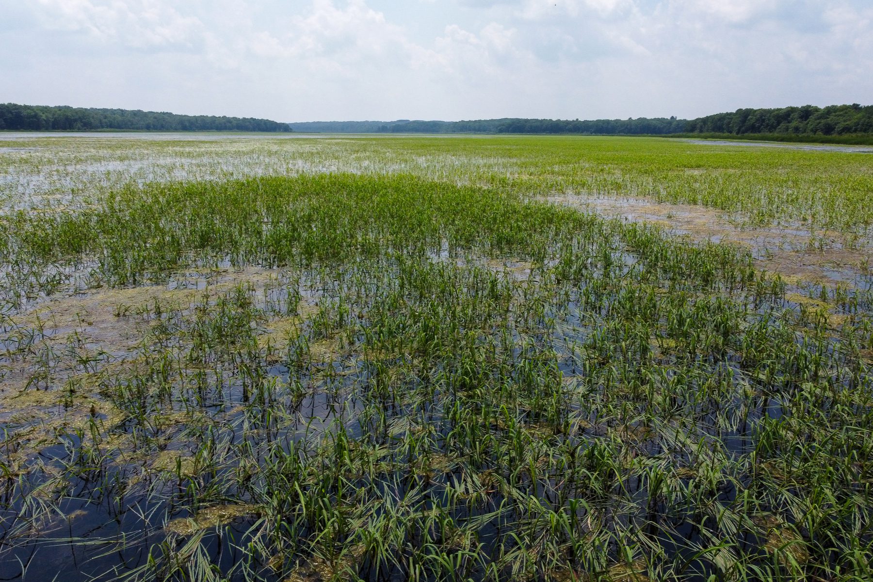
Sahan Journal reports that Indigenous communities in Minnesota are seeing their traditional wild rice harvests endangered by flooding and rising water levels. Wild rice grows in shallow lakes and rivers, and Tribal Nations have worked hard to restore and maintain wild rice beds. One successful project modulated a dam to lower water levels and let rice thrive again. But climate change means Minnesota is getting warmer and wetter. Last year, the Bois Forte Band of Chippewa saw their wild rice harvests largely destroyed by spring flooding.
In all of these situations, as the stories in this collaboration show, there are ways to mitigate the impacts of flooding and help communities prepare and recover, if the communities are directly involved in the solutions.
“If we want to be equitable, this is the time where we hold ourselves accountable,” says Davis, from the Alliance for the Great Lakes.
She adds that even though the new federal funding prioritizes environmental justice and community participation, much effort is needed to not only bring local leaders to the table but make sure grassroots organizations actually have the capacity to meaningfully participate.
“We have to acknowledge we’re starting at a deficit for a lot of the community groups — they’ve been doing this on a shoestring budget. This is the opportunity for them to really staff up and get the assistance they need, [and] be an integral part of this fight for the long haul.”
This story is the introductory piece in a six-part collaboration — “Inundated: Flooding and vulnerable communities in the Great Lakes region”— that includes the Institute for Nonprofit News, Borderless, Ensia, Grist, Planet Detroit, Sahan Journal and Wisconsin Watch, as well as the Guardian and Inside Climate News. The project was supported by the Joyce Foundation.